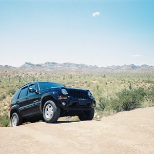
AZ july trip, common wheelin w us

Disclaimer: Links on this page pointing to Amazon, eBay and other sites may include affiliate code. If you click them and make a purchase, we may earn a small commission.

AZKJ

Full Access Member
Joined
Mar 11, 2007
Messages
1,118
Reaction score
1
Location
Mesa, AZ
The trail to the ovens does branch off of that route, but going the way AJ is talking about steers you clear of the property the Coke Ovens are on. Made a wrong turn the first time I was going out to the ovens and actually wound up heading down the route he is talking about. Of course our destination was the ovens so we did an about-face at the river and headed back out.
The man knows his trails!!!:D ;) :cool:
 

rkeegstra

Full Access Member
Joined
Jun 10, 2007
Messages
180
Reaction score
1
Location
Tucson, AZ
From Hwy 79 South, you can go in on Price Rd (on the left as soon as you cross the RR tracks). That route will take you through Box Canyon and then on to the Cabin. On the way out, you can swing down to the Gila River and then follow the trail up through scenic Walnut Canyon which skirts the White Canyon Wilderness area. You'll come out on Hwy 177, south of Superior.

I'm up for the route AJ suggests here, Price Road (Box Canyon) in, Coke Ovens/Battleaxe out. Thoughts?
 

AZKJ

Full Access Member
Joined
Mar 11, 2007
Messages
1,118
Reaction score
1
Location
Mesa, AZ
If you guys decide to go in through Box Canyon, I would highly recommend full skids. There are a few spots you will definitely scrap bottom if you're not super carefull. You should also be prepared to use the "RockStacker 2000".... :D
 

o8k

Full Access Member
Joined
Mar 21, 2007
Messages
742
Reaction score
3
im quite adept at stacking rocks so no worries, im skidded up for the most part too but not totaly.

Arent the coke ovens closed to us? So far its just you and me Russ, corwyyn? anyone? Someone? Where ya wanna meet?
 

AZKJ

Full Access Member
Joined
Mar 11, 2007
Messages
1,118
Reaction score
1
Location
Mesa, AZ
im quite adept at stacking rocks so no worries, im skidded up for the most part too but not totaly.

Arent the coke ovens closed to us? So far its just you and me Russ, corwyyn? anyone? Someone? Where ya wanna meet?
Yes, the coke ovens are in that area, but like Russ said above, they are closed. Box Canyon, the Cabin and the trail out will be a full days trip.
 

rkeegstra

Full Access Member
Joined
Jun 10, 2007
Messages
180
Reaction score
1
Location
Tucson, AZ
If we're going to go in the Box Canyon route, let's go ahead and meet up at the Price Station Road turnoff, which is right where the tracks cross 79 north of "downtown" Florence. South side of the tracks, east side of 79.

Or, if you want to do an easier way in we could do Cottonwood Road or Mineral Mountain Road. Name your route, pick a time. Earlier is better.
 

o8k

Full Access Member
Joined
Mar 21, 2007
Messages
742
Reaction score
3
box canyon route sounds good to me. as for the time, need to see if my buddy is commin w/ me, he couldnt get his chevy to pass smog so not sure whats happening there with that, I was planning on staying w/ him fri night as he's in tucson, tho if he bails, i suppose ill be driving down sat morning in which case "way" early may be a stretch. if i leave at 6:00am, wonder how long it would take me to get there..... 8? have to map it out...
 

rkeegstra

Full Access Member
Joined
Jun 10, 2007
Messages
180
Reaction score
1
Location
Tucson, AZ
We'll see how it works out. Of course if you're just going to be in Tucson, there are some trails south of town - Gunsight Pass, or Gardner Canyon, or Bull Springs Road.
 

Corwyyn

Full Access Member
Joined
Feb 5, 2005
Messages
2,524
Reaction score
7
Location
Southeast of disorder...
if i leave at 6:00am, wonder how long it would take me to get there..... 8? have to map it out...
Google Earth shows 86 miles from Yuma/Cotton Ln to Price Station rd. As far as the run goes, it would probably be quicker to go in thru the south end of Box Canyon (the way AJ suggested). The route in thru Cottonwood Canyon is nice but seems to take forever. I'd love to go but have a couple of things standing in the way 1) I probably won't know until the last minute if I am working this weekend, 2) I really need to find some tires to put on the back end - the ones I rotated off the front are just too worn to be trusted much longer. I'm going to call around Wednesday or Thursday to see if I can find some used 245s with at least some tread on them that will last until I can get new ones. If the moon's phase is right and the planets align I might be able to make it...
 

rkeegstra

Full Access Member
Joined
Jun 10, 2007
Messages
180
Reaction score
1
Location
Tucson, AZ
I'm keeping a close eye on the weather, right now the forecast is looking a little dicey - 30% chance of rain all day, not just in the afternoon. I don't want to be in there if it could be raining anywhere within twenty miles.

Russ
 

rkeegstra

Full Access Member
Joined
Jun 10, 2007
Messages
180
Reaction score
1
Location
Tucson, AZ
I'm gonna weenie out, the LOST people have pretty much talked me out of this run. They are under the impression that this is not a stockable trail, and this *is* my tow vehicle.

Like I said, if you are in Tucson, we can still try to hit one of the Tucson trails.
 

o8k

Full Access Member
Joined
Mar 21, 2007
Messages
742
Reaction score
3
agreed ill review my book as i dont know any of the trails down there, i did have a few thoughts about the trip i posted in LOST about but w/ the weather and all, im down for changing venues all together.

C
 

rkeegstra

Full Access Member
Joined
Jun 10, 2007
Messages
180
Reaction score
1
Location
Tucson, AZ
On the north side there is the easy but bumpy trip up the backside of Mt. Lemmon. South of town check out Gunsight Pass, Bull Springs Road, or Gardner Canyon.
 

o8k

Full Access Member
Joined
Mar 21, 2007
Messages
742
Reaction score
3
its "1$ you call it" night! im in how do we get there?
 

rkeegstra

Full Access Member
Joined
Jun 10, 2007
Messages
180
Reaction score
1
Location
Tucson, AZ
Mt. Lemmon control road starts in Oracle north of town and ends back in Tucson. It's an easy gig but it's close.

Bull Springs Road is about an hour south of Tucson off I-19 in Arivaca Junction and ends way down south of Patagonia on 82 (so long drive back).

Gardner Canyon (a shorter trail) starts and ends also about an hour south of town, off 83, south of I-10.

Gunsight Pass is just north of Gardner Canyon.

If you don't want to drive a lot I'd say lets go with Mt. Lemmon. Otherwise maybe Bull Springs Road. Thoughts? Anyone else, feel free to chime in as well...
 

o8k

Full Access Member
Joined
Mar 21, 2007
Messages
742
Reaction score
3
Im in for an offroad adventure, be it some point of interest, scenery, or a bit of a challenge as a technical trail, or playing in the sand. Any of these will do, tho my least interest in technical challenges, crown king tired me out for a while in that dept. Im not picky on the milage so no worries there. Have you done all of these? If not lets do the one you havent done, if you have done all of em, pick one you like and show me arround. havent wheeled down in tucson yet......


=)
 

AZKJ

Full Access Member
Joined
Mar 11, 2007
Messages
1,118
Reaction score
1
Location
Mesa, AZ
If I may chime in here... if you did Crown King, Box Canyon is no big deal. There are only two, maybe three spots where you may have to use your rock stacker to get up and over. The rest of the trail to the Cabin and the way out pose no problems.

Kevin, what's your opinion???
 

rkeegstra

Full Access Member
Joined
Jun 10, 2007
Messages
180
Reaction score
1
Location
Tucson, AZ
I've only done Mt. Lemmon.

Let's go with Bull Springs Road then. We can meet at the giant cow skull (the parking lot of the Longhorn Bar & Grill) in Arivaca Junction. Get off at the Arivaca Road exit, turn right (west) on Arivaca Road and immediately turn right (north) again. Really, you can't miss it.

How about 9:00?

Bull Springs Road pretty much skirts along the south-west edge of the Santa Rita Mountains.

Depending on the time and weather we could pop in on Temporal Gulch, Gardner Canyon, or Gunsight Pass on the way back.
 

o8k

Full Access Member
Joined
Mar 21, 2007
Messages
742
Reaction score
3
k done =) the other thing here too, since its just us two, better to stick to an easier trail in case of trouble. we are both posting back and forth july/aug tonight out of sync... e.g your prolly posting to my last post in aug thread right now then will come back to this one while i go to that one =)
 

rkeegstra

Full Access Member
Joined
Jun 10, 2007
Messages
180
Reaction score
1
Location
Tucson, AZ
...stick to an easier trail in case of trouble

Shouldn't be a problem. ExpeditionsWest calls it a 2.5 on their scale (Rugged Track: Not suitable for 2wd vehicles, or low clearance cross over vehicles. AWD required, Low Range preferred.), but it seems that everything they do is 2.5, 3, or 3.5 on their 1-5 scale. Martinez Canyon? 3.5.

Judging from the topo map we're not looking at any slot canyoning, many wash crossings but not much wash traversing, so we shouldn't be in more trouble than usual if it rains.

Now I'm off to respond to whatever you posted in the August thread.
 
Top