AZ KJcountry AUGUST TRIP 2.0

Disclaimer: Links on this page pointing to Amazon, eBay and other sites may include affiliate code. If you click them and make a purchase, we may earn a small commission.

o8k

Full Access Member
Joined
Mar 21, 2007
Messages
742
Reaction score
3
AZ KJcoutntry AUG TRIP 2.0 Details:
===============================================
TRAIL NAME: Montana Mountain (wells #48)
DIFFICULTY: Moderate: Stock vehicles can run it.
MEETING DATE: Sat, Aug 18th
MEETING TIME: 8:30AM hit trail at 9:00AM
MEET AT: Texaco Station on the North side of US 60, in Gold Canyon
<ADDRESS SEE MAP BELOW>
ROSTER:
o8k(solo),
AZKJ(w/ lead spotter),
Desertkj (?),
rkeegstra(w/ copilot),
minimedic(w/ copilot?)
M&P40(solo)
TOTAL TO DATE: 8-9 people 6vehicles
NOTES: LOST Members Always welcome.
================================================
 
Last edited:

AZKJ

Full Access Member
Joined
Mar 11, 2007
Messages
1,118
Reaction score
1
Location
Mesa, AZ
Sounds good to me. Beth and I will be there rain or shine.... :)

Any suggestion for a start time: 8:00 - 8:30 - 9:00 - 9:30 ???

Note: The Texaco Station is now a Shell Station
7138 E US 60
Gold Canyon

NW corner of US 60 & Mountainbrook Dr

You must be registered for see images

o8k... if you're going to keep coming solo, then you need to get a Jeepin Pup....
:D :p ;)
 
Last edited:

o8k

Full Access Member
Joined
Mar 21, 2007
Messages
742
Reaction score
3
like a puppy?
btw tnks for the map,
meet at 8:30 hit the trail 9:00am?

Unless someone is going to have any issues w/ this time speak now or forever hold your peas....????
 

AZKJ

Full Access Member
Joined
Mar 11, 2007
Messages
1,118
Reaction score
1
Location
Mesa, AZ
Scouting Report: Montana Mountain Road (Well's #48)

We had a few hours to kill this morning, so Beth I thought it best to use the TJ for a scouting mission to check out the trail conditions before leading everyone into the wilderness in a couple of weeks, especially since we haven't been out there in a few years.

The trailhead is about 30 minutes from our "Hacienda" and the exit point is another 10 minutes down the road from the trail head, so we decided to check them both.

===============

The GOOD NEWS... The desert is nice and green from the recent Monsoon rains. Going in the way described in the Wells book is not a problem. We don't forsee any problems getting to the top of the mountain and coming back down the other side on the switchbacks.


===============

Note... About five miles from the END of the trail, is the toughest part of the 30 mile loop that NEEDED to be checked out before committing to this trip. The washes and arroyo's in this area show signs of recent runoffs. That in itself would not be an issue IF we did this trail in reverse, then we'd be through that area if it started to rain later in the day.

===============

The BAD NEWS... The really bad part of this trail, is about .4 mile in length, broken down into three shorter sections which are close together. The trail runs in a very rocky creek bed, with some pretty large rocks. I don't know if it's because of the recent rains or what, BUT it is definetly worse than the last time we ran it.

Take a look at the pictures below and keep in mind they do not give a true perspective of what the trail is really like. In our opinion, a stock KJ, even with full skids and good A/T tires, would have one heck of a time getting through this short section of the trail. The TJ made it through with some carefull driving and minor scraping, but it sits up higher than the KJ. It also rides on better tires... 31x10.5 BFG M/T tires.

===============

Conclusion... We DO NOT RECOMMEND this trail for a KJ at this time. Those without skids would surely break something as would those with skids, if they were not super careful.

===============

Alternate Plan... The area is pretty because of the recent rains. It is a nice drive to the top of Montana Mountain, with a few fun spots along the way. The ride down the other side, on the switchbacks, is scenic and fun. There is a short side trail that leads down to an old stone cabin we can explore. We all would continue on a few miles to the VERY ROCKY part of the trail. At that point, those who want to run it can do so as the others watch you fade off into the sunset. Beth and I will turn around there, go back up the switchbacks and out the way we came in. Total off road travel turning around is 55 miles, 30 for those that want to do the tough part of the trail.

We plan on having dinner in Superior at the old Mexican Restaurant at the end of the run.

OR... Come up with another trail entirely.

What does everyone else want to do?

The roughest part of the trail starts here...

You must be registered for see images


It starts to get bad from this point on for about .4 of a mile...

You must be registered for see images


And it only get worse...

You must be registered for see images


You must be registered for see images


Going out of the wash then back in the way we came...

You must be registered for see images


You must be registered for see images


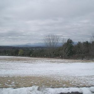
We should have gotten out here to give some perspective of the trail...

You must be registered for see images
 
Last edited:

rkeegstra

Full Access Member
Joined
Jun 10, 2007
Messages
180
Reaction score
1
Location
Tucson, AZ
I don't have any problems going up Montana Mountain and turning around. Or, we could always keep an eye on the weather and do the original Wickenburg run if it looks promising. Right now, for example, next weekend is looking good in Wickenburg.

We're easy to please and don't have any strong preferences.

Russ
 

o8k

Full Access Member
Joined
Mar 21, 2007
Messages
742
Reaction score
3
I did u a run out to sattle mountain today out in tonopah it was quite secnic. ill pot some pics when i get home, it is a series of moderate to easy trails that encircle the sattle mountains, with many bypasses where there are tricky spots.

also, i passed over the hacienda river where it crosses the 10 and it was bone dry. not sure if that means anything er not.

ideas:

1 run the montana mnt as described.
2 scout further up the hacienda tomorrow,er next weekend and see how it looks
3 sattle mnt trip if it looks interesting to yall
4 any other ideas welcome

personally im leaning towards the backup plan mantioned for montana mnt, because it is so centrally located. second best in mt mind is the original trip again. i will prolly scout bch tomorrow either way.

but if someone has a wild hair idea (like sattle mnt) its woth hearing about. trouble w the sattle mnt is its several shor runs that only take a few hours total, maybe 3 or 4, but the area is plain beautiful
 

Corwyyn

Full Access Member
Joined
Feb 5, 2005
Messages
2,524
Reaction score
7
Location
Southeast of disorder...
Well, after looking at AJ's pictures I dunno. I lead a couple of stock height KJs thru similar terrain in Box Canyon back in January, they had skids underneath and scrapped a bit but made it thru just fine. My personal opinion would be that it's doable with good spotting, for the short climbs up the banks you could always strap. Of course, it is looking more and more like I'll mis this one so you folks can hash it out amongst yourselves.
 

AZKJ

Full Access Member
Joined
Mar 11, 2007
Messages
1,118
Reaction score
1
Location
Mesa, AZ
Yeah, it's a toss of the coin. Anything is doable. The question is, do we want to risk someone tearing up their ride (and in most cases, their daily driver)? Everyone in the group doesn't have skids yet and I'd hate to have them pass on this trip.

I've been in Box Canyon several times. From what I remember there was one or two ledges to get over and even one place where you could get high centered if you weren't careful, but I don't remember a rock field about .4 of a mile long as what we saw yesterday.

I don't know, maybe it's old age or something for not wanting to take risks for no reason. We can go ahead and run the trail, and see what it looks like. When we get to the wash in question, we can continue on, or turn around if need be. I would have no problem with turning around and going back the way we came in with the folks that don't want to risk it in the wash.

If 08k AND another vehicle can scout the river as far down as the box canyon next weekend and let us know what condition it's in, we'd be up for that too. (Note: it's not a good idea to go in alone if there is water at the entry point... it only gets deeper as the trail narrows).

We're in for whatever trail that's picked, but we need to pick one soon and stick with it so folks can make plans....
 
Last edited:

o8k

Full Access Member
Joined
Mar 21, 2007
Messages
742
Reaction score
3
hehe haha, yes thats funny how u put it the fist time, me AND another driver. if i do any scouting on my own, i wasnt planning on venturing vry far, basicly find the trail, ask some questions in town, drive over the river where its paved ect. if amyone is willing next weekend to check it out im game. nxt weekend ill b 2.5 iches taller too.

also, im with corwyyn we can just run the mountain and turn around if it just doesnt look good.

might be a good learning experience here.....another part to learning how to wheel is learning how to say no to somthing to somthing tempting to do, esp in a group thats even harder. but good expierience. ive done dozzens of high adventure trips, tho im new to the 4x4 scene, like expedition caving, with a team, no guide just us and a book like the wells book ect. alomg w mountain treks ect. esp in the caves whrer theres no guide, you have to make very mature and calculated decisions about where not to go, and when to turn around. we planned an expidition one year and drove 10 hours only to get to our cave and it was raining, you think washes flood in rain! caves are worse. we had to scrap the whole thing and just camp out for the weekend, still had a blast tho.
 
Last edited:

o8k

Full Access Member
Joined
Mar 21, 2007
Messages
742
Reaction score
3
lets run montana mnt as planned!

and turn around if its too hairy, our turn arround point will be bases on our lowest common denominator vehicle ability. and everyone remember, when we turn back due to danger, the fun is NOT spioled at that point, no one feel bad because truley, the fun IS PRESERVED. looks like there is plenty of fun to be had out there with out the said boulder field. if its only 0.4 miles worth, get there, let people who want to play on it play,,, then all turn round and go eat... =)

side joke, corwyyn said we could do it with a good spotter... do we ahve one? hehehehe jusk kiddin....
 

AZKJ

Full Access Member
Joined
Mar 11, 2007
Messages
1,118
Reaction score
1
Location
Mesa, AZ
Okay "Mr 2.5 Inches Taller"... I know where you're coming from. YOU just want to check out the rocks. J/K

Sounds good, so we're still on for Montana Mountain (Wells #48) as planned....
 

o8k

Full Access Member
Joined
Mar 21, 2007
Messages
742
Reaction score
3
ya 2.5 getting tried of hoisting rocks all over the place,, hehehe jk ive always been an advocate of the ,theres no shame in stacking rocks, club.... still am, i follow the McGuyver style of wheeling, use anything and everything to make it go. just wait till i get my ramps out of storage. =) then yall can really raz me.
 

Corwyyn

Full Access Member
Joined
Feb 5, 2005
Messages
2,524
Reaction score
7
Location
Southeast of disorder...
I've been in Box Canyon several times. From what I remember there was one or two ledges to get over and even one place where you could get high centered if you weren't careful, but I don't remember a rock field about .4 of a mile long as what we saw yesterday.
Well really there isn't unless you turn right into a wash where you should have stayed left, and by the time you figure out the mistake it's just easier to go forward than to try and back out :eek: I took a couple of lines that the stockers stayed away from (just to show them what the KJ was capable of) but we still got them thru. I think that section was about 200 yds long, still lots of fun :D

And yeah, they have paved a lot of the tougher sections in Box Canyon. I remember when this one was actually fun:
You must be registered for see images attach

This time they had so many rocks stacked in that cut that one of our groups saw some small car (Metro or something like that) back at the turn for Martinez Cabin :eek: Maybe the rains have washed all of them away...
 

AZKJ

Full Access Member
Joined
Mar 11, 2007
Messages
1,118
Reaction score
1
Location
Mesa, AZ
...side joke, corwyyn said we could do it with a good spotter... do we ahve one? hehehehe jusk kiddin....

You must be registered for see images


And she really is.... :) :D :eek:
 
Last edited:

o8k

Full Access Member
Joined
Mar 21, 2007
Messages
742
Reaction score
3
lol thats funny. My first thought was i internalized the spotter thing, i've only spotted a few times, and not sure if there's some standard hand signes er somthing for what to say for what er whatever. Not to mention all the trips we've done have been fairly not spotter nessisary...I think im a good line reader and all but still....

Either way that picture is darn funny! Good to know we have the tallent we need! =D
 

minimedic

Full Access Member
Joined
Jun 7, 2007
Messages
51
Reaction score
0
Location
queen creek, az
Well, I'm up for anything. I'll trust your judgment if you tell me I can do it in my stock, then I'll do it!! :D I'll meet you there! Got a tow strap, a rear hook coming and getting ready to order the front hooks, would love to get the skid plates b4 then, but got no $$.
 

o8k

Full Access Member
Joined
Mar 21, 2007
Messages
742
Reaction score
3
great to hear! I ran crown king with basically no skids just needed extra spotting action. there is always enough trail out there to keep us busy well spot ya, see u then!
 

o8k

Full Access Member
Joined
Mar 21, 2007
Messages
742
Reaction score
3
Looks like Im good for sunday. Will that work? If so, where you wanna meet?
Havent heard from Ram50 yet....
 

M&P40

Full Access Member
Joined
Aug 10, 2007
Messages
189
Reaction score
0
Location
Chandler AZ
is this run going to be sat 18th or sun 19? does not matter to me. i think there is a run around tuscon that AZLOST is planning but i would rather run montana mountain being that it is way closer to me i am just confused :confused:
 

minimedic

Full Access Member
Joined
Jun 7, 2007
Messages
51
Reaction score
0
Location
queen creek, az
The run is on Sat the 18th. I believe o8k was meetin up with someone on Sunday (today) to scout a trail. See ya then!
 
Top