
CMax26az
New Member
We will be meeting on Sunday morning at 8:30am at the Anthem Wal*Mart parking lot. We will depart promptly at 9am
Directions: Take the I-17 north and exit on ANTHEM WAY, go LEFT, at the next stop sign you will see the Wal*Mart on your left, we will meet in the north/west corner of the parking lot.
CB radio: Channel 4
FRS radio: Channel 4
The Table Mesa rd, east trail
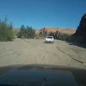
Trail Description: Very scenic drive, considered moderate terrain. high clearance vehicles recommended. Lockers are not needed. Trail is very rocky and bumpy. there are some optional 3.0 roads to take. I recommend stopping at the old cabin for lunch, after that the trail calms down and becomes a 2.0 at best. There is a fun hill to climb towards the end.
Note:Arizona State Land Recreational Permit required on first mile or so of this trail. (which i can get this week at the office in downtown)
as of 05/01/2005 This trail has been graded and some of the harder byp***es blocked. Downgraded its rating to just 2.5
GPS CORDS
01 N33 58' 05.5" W112 07' 34.3"
02 N33 58' 20.0" W112 03' 45.1" (Right)
03 N34 00' 34.1" W111 57' 14.0" (Right)
04 N34 00' 32.5" W111 52' 45.0" (Right)
05 N33 52' 42.2" W111 48' 54.0" (straight)
06 N33 47' 57.7" W111 57' 46.7" (Right)
After ths weekends rain I would expect the washes to be more challenging along with new mud. We were in this area on Sunday playing in the rain and the big washes where REALLY going wild. After the run we could stop in Cave creek and get dinner at Harold's Corral. Should be a nice day run, good for stockers (sorry to you guys looking for the bigger challenges). From trail head to Cave Creek is about 40 miles so figure for 6-7 hours and bring lunch with you ON THE TRAIL.
if you are a member on LOSTkjs.com please use this link and respond there
http://www.lostkjs.com/forum/phpBB2/viewtopic.php?t=29038
If not, respond to this thread to get an idea of how many we will have.
Directions: Take the I-17 north and exit on ANTHEM WAY, go LEFT, at the next stop sign you will see the Wal*Mart on your left, we will meet in the north/west corner of the parking lot.
CB radio: Channel 4
FRS radio: Channel 4
The Table Mesa rd, east trail
Trail Description: Very scenic drive, considered moderate terrain. high clearance vehicles recommended. Lockers are not needed. Trail is very rocky and bumpy. there are some optional 3.0 roads to take. I recommend stopping at the old cabin for lunch, after that the trail calms down and becomes a 2.0 at best. There is a fun hill to climb towards the end.
Note:Arizona State Land Recreational Permit required on first mile or so of this trail. (which i can get this week at the office in downtown)
as of 05/01/2005 This trail has been graded and some of the harder byp***es blocked. Downgraded its rating to just 2.5
GPS CORDS
01 N33 58' 05.5" W112 07' 34.3"
02 N33 58' 20.0" W112 03' 45.1" (Right)
03 N34 00' 34.1" W111 57' 14.0" (Right)
04 N34 00' 32.5" W111 52' 45.0" (Right)
05 N33 52' 42.2" W111 48' 54.0" (straight)
06 N33 47' 57.7" W111 57' 46.7" (Right)
After ths weekends rain I would expect the washes to be more challenging along with new mud. We were in this area on Sunday playing in the rain and the big washes where REALLY going wild. After the run we could stop in Cave creek and get dinner at Harold's Corral. Should be a nice day run, good for stockers (sorry to you guys looking for the bigger challenges). From trail head to Cave Creek is about 40 miles so figure for 6-7 hours and bring lunch with you ON THE TRAIL.
if you are a member on LOSTkjs.com please use this link and respond there
http://www.lostkjs.com/forum/phpBB2/viewtopic.php?t=29038
If not, respond to this thread to get an idea of how many we will have.
Last edited: