incline

Disclaimer: Links on this page pointing to Amazon, eBay and other sites may include affiliate code. If you click them and make a purchase, we may earn a small commission.

XWrench3

Full Access Member
Joined
Sep 30, 2020
Messages
182
Reaction score
41
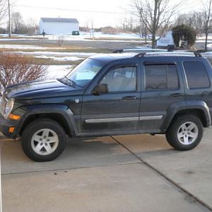
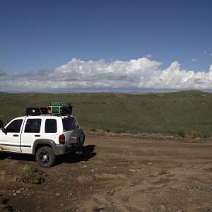
So I have been watching a you tube channel called "Matt's Off Road Recovery" lately. and in one of the past few video's, one of his friends purchased and gave to Matt, a clinometer. which I thought was a pretty neat gift. around my home there would be no where I would need one, but this summer I am going to try to talk my brother into going back up to the West Branch - St. Helen area where we used to dirt bike 30+ years ago. and some of those "little bumps" are knarly enough that a clinometer might be handy. BUT, it will only be handy if I know the tipping point of my Liberty prior to rolling it! so, without wrecking my Jeep, how do I go about figuring that out? I know that many factors go into it. is there a static angle which you start at and go from there? I KNOW that at least one person rolled his Jeep up there, as we were dirt biking and we came across an ambulance driving up the gravel road. he rolled it, but did not have his seat belt on, and as it rolled, he got ejected, and he got caught between the roll bar and the sand. he didn't make it. while I wouldn't have that problem, as I wear the seat belt all of the time. but rolling the Liberty would mean the loss of my daily driver. and I am to old and dilapidated to walk out!
 

LibertyTC

Well-Known Member
Staff member
Moderator
Joined
Oct 24, 2008
Messages
9,097
Reaction score
1,765
Location
B.C. Canada
Are you lifted with skid plates? Narley roads 30 years later may be not as bad as you think today?
Are there any off road/ current contour maps of the area? One of the clubs around there may be able to advise better about current road conditions.
Ya the tilt-o-meter ... Don't go crazy. If there was anything really serious off angle, you will know about it pretty quick.
I remember a few years after Mt St. Helen's erupted going back to Toutle River area.
What a mess ! I got photos and was amazed by the powerful & complete destruction.
 

XWrench3

Full Access Member
Joined
Sep 30, 2020
Messages
182
Reaction score
41
no lift, yet. but I do have full skid plates. and they are not roads. they are 2 tracks, I guess fire access roads would be the best way of describing them. they were pretty challenging even on motorcycles. i did see a few dune buggies climb them though. but they had a lot better power to weight ratio than a Jeep Liberty.
 

CrazyDrei

Space Monkey
Joined
Dec 10, 2020
Messages
176
Reaction score
161
Location
Maine
There are several inclinometer apps out there. Might be worth downloading and playing with.
 

sleazy rider

Retired moto tech and gearhead
Joined
Dec 8, 2020
Messages
540
Reaction score
499
Location
SE Michigan
no lift, yet. but I do have full skid plates. and they are not roads. they are 2 tracks, I guess fire access roads would be the best way of describing them. they were pretty challenging even on motorcycles. i did see a few dune buggies climb them though. but they had a lot better power to weight ratio than a Jeep Liberty.

You talking about the Au Sable River recreation area? I went thru there on an XR600R a long time ago. No worries about power with that BRP. lol. Mom lived in Prudenville and we'd sneak up at least once a month with one of the play toys.
 

XWrench3

Full Access Member
Joined
Sep 30, 2020
Messages
182
Reaction score
41
actually the area around ski park hill and the St. Helen trail.
 

Latest posts

Members online

Top